
Tuesday, March 15, 2016
Southwest Groundwater Surveyors, Find Water First
Southwest Groundwater
Surveyors / Find Water First Inc help clients locate groundwater for drilling in these following Southwestern areas
in the US:

We
use modern technology to help locate groundwater and give you reasonable
assurance that you are drilling in the right place and depth. Our seismoelectric technology has shown high success rates to many drillers, well
developers, farmers, golf courses, and land developers!
Sunday, February 17, 2013
Method to Find Well Water Before Drilling
The Seismoelectric Method is the only known method for seeing the underground aquifer directly. Where other methods may determine the depth and the porosity of the underlying rock matrix a few hundred feet below ground; but at best they can only guess whether water is present or not.
Southwest groundwater Surveyors seismic well water survey method has been found to be the most accurate, best method to find well water for drilling. In addition, groundwater surveying is very cost effective compared to the price of drilling a dry or less productive well. We have the instruments and the ability to see the aquifer prior to the well being drilled, We can see the groundwater aquifer to a depth of 1500 feet below ground.
This has become the method of choice to find water for farms land-owners, , developers, utility companies, well drillers, farms, ranches, geologists, home owners, and anyone who needs a reasonable assurance of drilling on the best location the first time. Why take a chance on a costly dry well?
 |
| Visit Southwest Groundwater Surveyors at https://findwaterfirst.com |
Southwest Groundwater Surveyors uses the proprietary Seismoelectric instruments and scientific methods for finding groundwater, measuring the aquifer and finding where to put a well. Because it is simply the most effective, accurate, and reliable method. Nothing else comes close.
Serving:
Southern California/Arizona/Utah/New Mexico/Nevada and other areas where our service is needed.
Geophysicist Ca957. Ron Sorensen is the officer in charge of Geophysics for Find Water First Inc.

Phone 1-800-394-6207
https://www.findwaterfirst.com
findwaterfirst@gmail.com
Monday, September 17, 2012
An Aquifer Is / An Aquitard is
An aquifer is
a water saturated permeable geologic layer, or fracture zone, that is able to
transmit significant quantities of water.
A geologic layer that cannot transmit significant quantities of water is
usually referred to as an aquiclude. An
aquitard is a rock unit that generally has a low permeability and hence will
transmit only very limited quantities of water and are generally not suitable
for production wells. The terms Aquifer
or aquitards can be used to define most geologic strata. The most common aquifers include permeable
sedimentary rocks such as sandstones, limestone’s, sand and gravel layers, and
highly fractured volcanic and crystalline rocks. Common aquitards are un-fractured shale’s,
clays and dense (un-fractured) crystalline rocks.
Sedimentary
aquifers form layers and usually have a large lateral extent, whereas aquifers
in fracture zones in igneous and crystalline rocks may have a very limited
lateral extent. When searching for water using any geophysical method,
including the Electro seismic method, the type of aquifer that may be present should
be considered, both when planning a ground water survey and especially when considering
drilling a well.

- Confined—An aquifer overlain by one or more layers of impermeable rock or soil that restrict water to within the aquifer. The water is confined under pressure. Drilling a well into a confined aquifer releases that pressure and causes the water to rise in the well. These wells are sometimes called artesian wells.
- Unconfined—An aquifer that is not overlain by a layer of impermeable rock or soil. Water in a well will naturally stay at the level of the water table. As water is removed from the well, the water table at that place is lowered, causing the surrounding ground water to flow toward the well.
Whether you are on a fractured rock aquifer, an artesian aquifer, a confined aquifer, an unconfined aquifer or have no groundwater at all, the benefits of a groundwater survey when planning a new well, far outweigh the costs of drilling a dry well.
Phone: 800-394-6207
Southwest Groundwater Surveyors serve California, Arizona, Nevada, New Mexico, and Utah.
Friday, September 7, 2012
Ideal Conditions for a Groundwater Survey Prior to Well Drilling

Having a reasonable expectation of finding well water prior to drilling a well is a great benefit for the prospective well owner. Southwest Groundwater Surveyor uses the seismoelectric method for locating the optimal well drilling location.
Briefly, the seismoelectric method, sometimes called electroseismic or Electro Kinetic Seismology (EKS) makes use of a phenomenon, known since the 1950’s, whereby an electrical signal is produced when a seismic wave encounters water within rock pores, such as is the case for an aquifer. Although the basic Physics of the method has been understood for many years, and numerous field demonstrations have been completed showing the feasibility of the method, it was not until 1996, when a company called Groundflow Ltd. and later AqualocateLLC developed and patented very specific electronics and associated techniques required to measure and interpret the EKS signal, making the method more practical. Whereby using these techniques, the EKS signal is recorded using a data recording geometry that significantly minimizes naturally occurring electrical noise. Groundflow Ltd developed the instrumentation to both record this signal and to process the data. Therefore allowing the existence of groundwater, (if present) to be inferred along with estimates of the depth and the yield of the aquifer.
Accuracy of interpretation of groundwater data may often be increased if a local well is available where the aquifer depth, thickness and flow rate are known. In this case a sounding can be conducted close to the well, which gives us a better velocity and acoustic attenuation model for the particular underlying rock matrix.
The ideal conditions for a groundwater survey are as follows...
- Access to the desired test sites on the property by a 4 wheel drive pickup truck.
- Survey sites must be at least 50 feet away from underground high voltage lines.
- Surveyors must be able to penetrate the ground surface to a three foot depth.


Friday, June 1, 2012
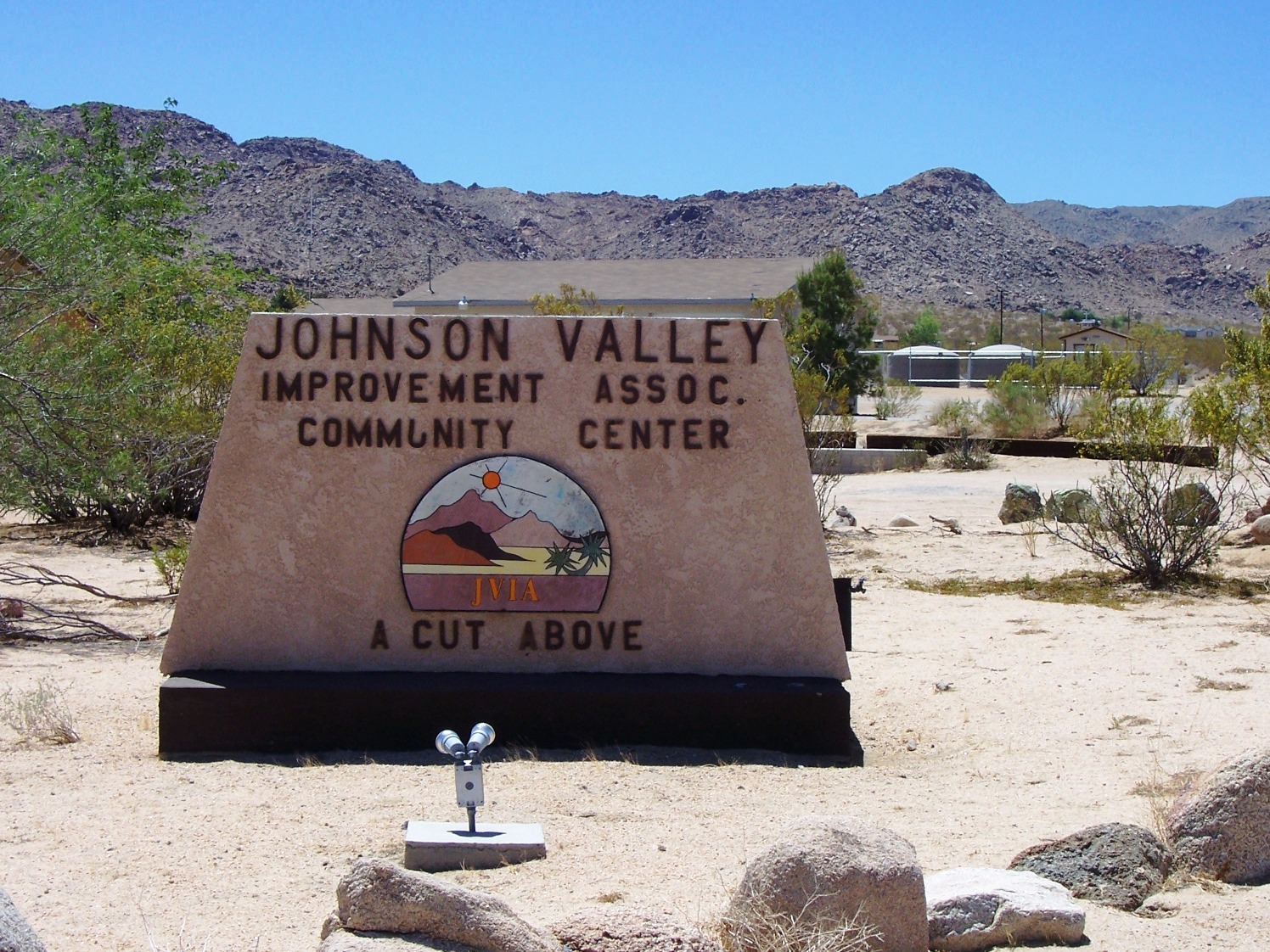
Finding well water in Johnson Valley
Southwest Groundwater Surveyors was hired to find a water well in Johnson Valley CA by the Johnson Valley Improvement Association. (a very arid desert region of Southern California). After conducting ten seismoelectric tests we determined that the best well water location would yield at least 10 Gallons per minute. The well was drilled by Solomon Drilling of Lucerne Valley CA. We are proud to announce that the Johnson Valley Improvement Center now has all the water they need and the well is yielding in excess of 10 GPM
If you are planning to drill a well contact us to find out how you can save on you well drilling budget.

If you are planning to drill a well contact us to find out how you can save on you well drilling budget.
Find well water the first time you drill with a groundwater survey from Southwest Groundwater Surveyors...
Contact us online or call 800-394-6207

Tuesday, July 13, 2010

Subscribe to:
Posts (Atom)